Home
Street Improvements
Street Improvements
Making the area more climate resilient and improving walking and cycling is not limited to reducing vehicles. We also need to improve the whole street environment. To do this in Streatham Wells, we have identified a series of ‘minor’ and ‘major’ improvements.
Funding for this Low Traffic Neighbourhood has come from various avenues, allowing us to maximise the opportunity to upgrade the area. The Local Implementation Plan is a grant fund from Transport for London that enables all boroughs in London to deliver the Mayor's Transport Strategy. The Highways Improvement Programme is our rolling maintenance programme that keeps our roads and pavements in good condition. We have invested £6million in the Sustainable Drainage Programme 2022-2025 to build Sustainable Urban Drainage Systems across highways and streets, open spaces, estates, and schools to sustainably manage storm water for the long-term and form part of the Council’s response to the impacts of climate change. In Streatham Wells, these are planned on Valley Road and Sunnyhill Road near Sunnyhill Primary School. These proposals for Sustainable Drainage Systems (SuDS) will be shared at a later date .
Major improvements
These change the way a street is used, they are more complex, longer-term changes, where road excavation and digging may be necessary. The council uses traffic orders for such interventions.
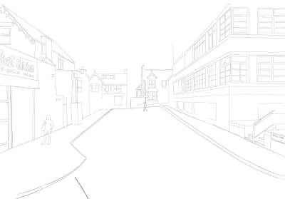
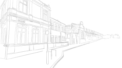
The following pages show before and after photos for various locations that have major improvements proposed:
You can let us know your thoughts through the feedback options. Information on Minor Improvements is on the last page of this section.
Click next to navigate through the pages.
Hopton Road
This side road to Streatham High Road has been identified as unpleasant and dangerous in feedback collected throughout the engagement period.
We would like to create a pocket park for local communities and introduce more greening into the area. This would also help people cycle to Streatham Station.
In terms of vehicle parking, the following changes would be included:
- Parking space on Hopton Road to be removed
- The car club bay and disabled parking bay to be relocated on Polworth Road around the corner
- Loading space for businesses would be provided around the corner on Hopton Road.


Download our template
Pinfold Road
Pinfold Road sees through-traffic disproportional to its size, and its entrances, much like other side-roads off the A23, feel dangerous to some due to the speed, frequency and aggression of turning movements in and out of the road.
We are proposing a pocket park outside the library, whilst restricting access for through traffic. This will make it easier to walk and cycle to the High Street and provide a space to rest away from the A23. The pocket park will also introduce more greening and space for local communities.
In terms of vehicle parking, the following changes would be included:
- Removal of parking outside of the library and the creation of a loading by outside 2-4 Pinfold Road to accommodate the businesses on Streatham High Road.
- Shifting the disabled parking slightly further east to accommodate vehicle turning.
- We are considering an exemption for loading access, so that vehicles can access the replaced loading bay.


Download our template
Sunnyhill Road
This is a main cut-through for private vehicles seeking to avoid the main roads. It sees congestion and speeding at a higher level than most residential roads, and both its entrances suffer particularly due to vehicles congregating at different times, for different reasons. We have heard it is often unpleasant and difficult to walk to local shops, and that the narrow pavement is often cluttered. We want to remove car parking spaces and widen the pavement to provide more space for local people.
The little parade of shops near the eastern end of Sunnyhill Road is currently a grey, under-utilised space. Here we are proposing to create more space for pedestrians, more seating and more greening, amongst wider improvements.
Whilst we currently have no identified budget to implement these proposals, we are still developing it in case additional funding does become available.
In terms of vehicle parking, the following changes would be included:
- Removal of parking outside 6-48 Sunnyhill Road to provide pavement widening
- Reduction of parking outside 17-21 Sunnyhill Road to provide a passing place
- Retention of the loading bay near the junction with Streatham High Road
- Removal of parking outside 131-139 Sunnyhill Road
- Reduction of parking outside 156-162 Sunnyhill Road


Download our templates


Valley Road
Valley Road carries a consistent flow of traffic travelling north-south and vice versa. Speeding is an issue that calming measures have only partially solved, and accidents are frequent. Congestion can be extreme, especially during the school run, due to the layout and size of the road being unable to manage such traffic volumes. This is particularly noticeable near Sunnyhill School, on the junction with Sunnyhill Road.
In terms of vehicle parking, the following changes would be included:
- Extending Double Yellow Lines on Gleneldon Road to provide space for pavement widening
- Extending Double Yellow Lines on Valley Road south of the junction to provide space for pavement widening

Gleneldon Road / Valley Road
We are proposing to convert the existing mini roundabout into a T-junction and widen the pavements to help people cross the roads and reduce traffic speeds. The sections of pavement widening feature more greening and planting.
We are also investigating a raised table, making the road the same height as the pavement. This would slow down traffic further and make it easier for pedestrians to cross.


Valley Road / Russell’s Footpath
We are proposing a footway buildout with planting to make it easier to cross Valley Road and walk along Russell’s Foothpath. The footway buildout will be paired with a priority giveway, slowing down traffic.
In terms of vehicle parking, the following changes would be included:
- Removal of parking south of the crossing point to allow vehicles to pass each other.
- Potential removal of parking north of the crossing point to allow vehicles to pass each other


Download our templates


Shrubbery Road
There is a severe issue with traffic volumes, congestion, and aggression on this side road. Feedback has been especially negative about its current dynamic. We are proposing to make Shrubbery Road a one-way street with allowance for contraflow cycling. This would make Shrubbery road exit only at the junction with the A23. We are also proposing a section of pavement widening halfway down the road to slow vehicles down.
In terms of vehicle parking, the following changes would be included:
- Removal of parking outside 45-57 Shrubbery Road to provide pavement widening
- Removal of parking outside 28-32 Shrubbery Road to provide space for vehicles to pass the pavement widening.
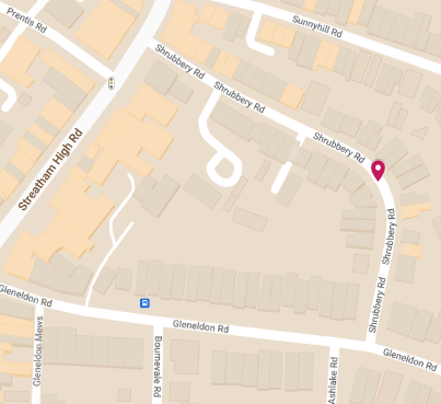


Download our template

Leigham Court Road
Speeding, congestion and air quality are some of the main issues that respondents have referred to in feedback. Several measures are being taken in a variety of ways to address these issues.
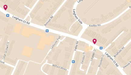
LCR at Dunraven 1 and 2
The pavements around the Dunraven schools can become quite congested, especially around school start/end times. We want to introduce pavement widening, to provide space for pedestrians. This is planned on the stretch between Dunraven Secondary School and Leithcote Path and between Dunraven Sixth and Mount Nod Road.
The proposals, will also provide more space for waiting at the bus stop and help to reduce car speeds. No changes in parking are proposed as part of these proposals


LCR - east of Valley Road junction
At this location, we want to introduce a section of pavement widening, to provide more space for the pedestrians. The pavement widening section will replace car parking and introduce more trees and green space. The designs will incorporate the existing disabled parking bay.
Whilst we currently have no identified budget to implement this proposal, we are still developing it in case additional funding does become available.
In terms of vehicle parking, the following changes would be included:
- Reduction of parking outside 153-213 Leigham Court Road
- Retention of the disabled parking bay outside 175 Leigham Court Road


LCR at St. Julian’s
The pavements outside of St. Julian’s Primary School can become quite congested and our road safety statistics show that there is a cluster of collisions at this location.
We want to introduce a section of pavement widening, to provide space for pedestrians. We will also provide a continuous crossing across St. Julian’s Farm Road, to provide a clearer pedestrian priority. No changes to parking are proposed as part of this proposal


Download our templates


Minor improvements
Minor improvements can be added quickly, placed on top of the carriageway. These improvements include planting new trees in existing tree pits or where currently there are stumps, installing more cycle parking hangars, and proposing a variety of parklets to create more community space, seating and greening.
The below maps showcase planned locations:
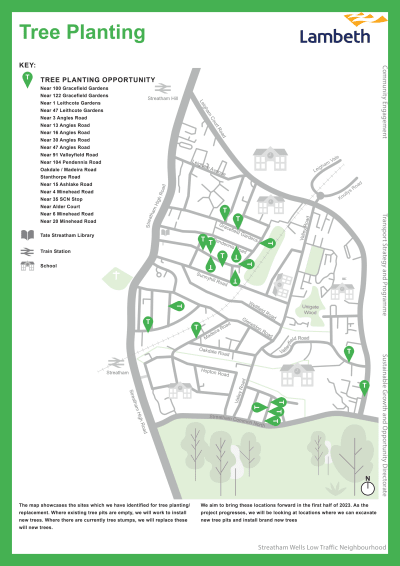
Tree Planting
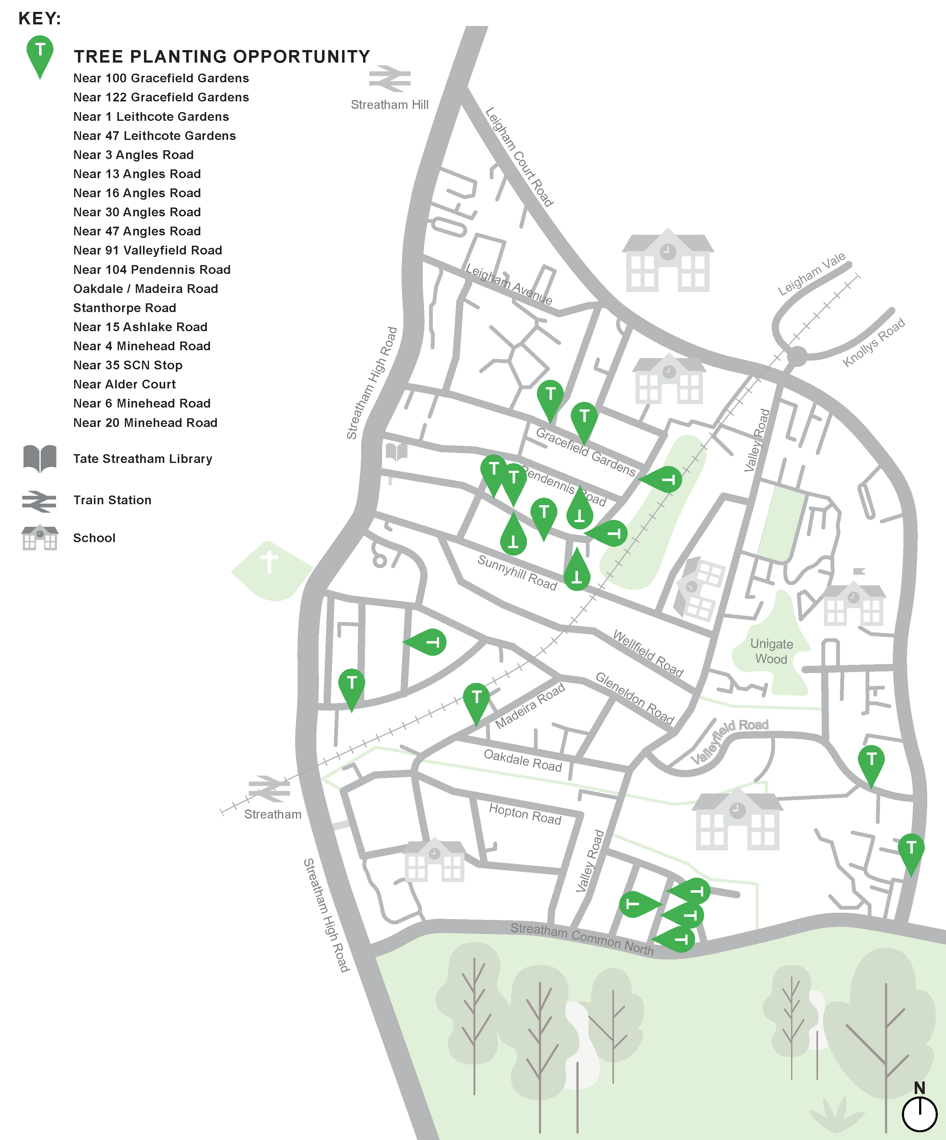
The map showcases the sites which we have identified for tree planting / replacement. Where existing tree pits are empty, we will work to install new trees. Where there are currently tree stumps, we will replace these will new trees.
We aim to bring these locations forward in the first half of 2023. As the project progresses, we will be looking at locations where we can excavate new tree pits and install brand new trees
Secure Cycle Parking

The map outlines the locations which we have identified for a secure cycle hangar. These locations have been based on local clusters of demand. We will continue to develop these proposals and aim to advertise them through the Traffic Order process in the first half of 2023. Local residents will be able to give their feedback throughout this process.
Parklets & Seating

The map outlines the locations which we have identified for parklets. These are structures that are placed in parking bays and can provide a range of different uses, including seating, greening, cycle parking and play features. The locations proposed have been identified through the engagement process. The proposed functions are shown on the maps.
For example, local residents have requested on multiple occasions if more seating could be provided for people waiting on the 315 bus, these requested for seating would be supplied through parklets. In the first half of 2023, Lambeth Council will be contracting a parklet supplier to further design these parklets and engage with local communities on their function and exact placement.
Check out the street improvement maps
This engagement phase has finished

...